The Yarra's slow bend through the city
Reference library · 1098 words
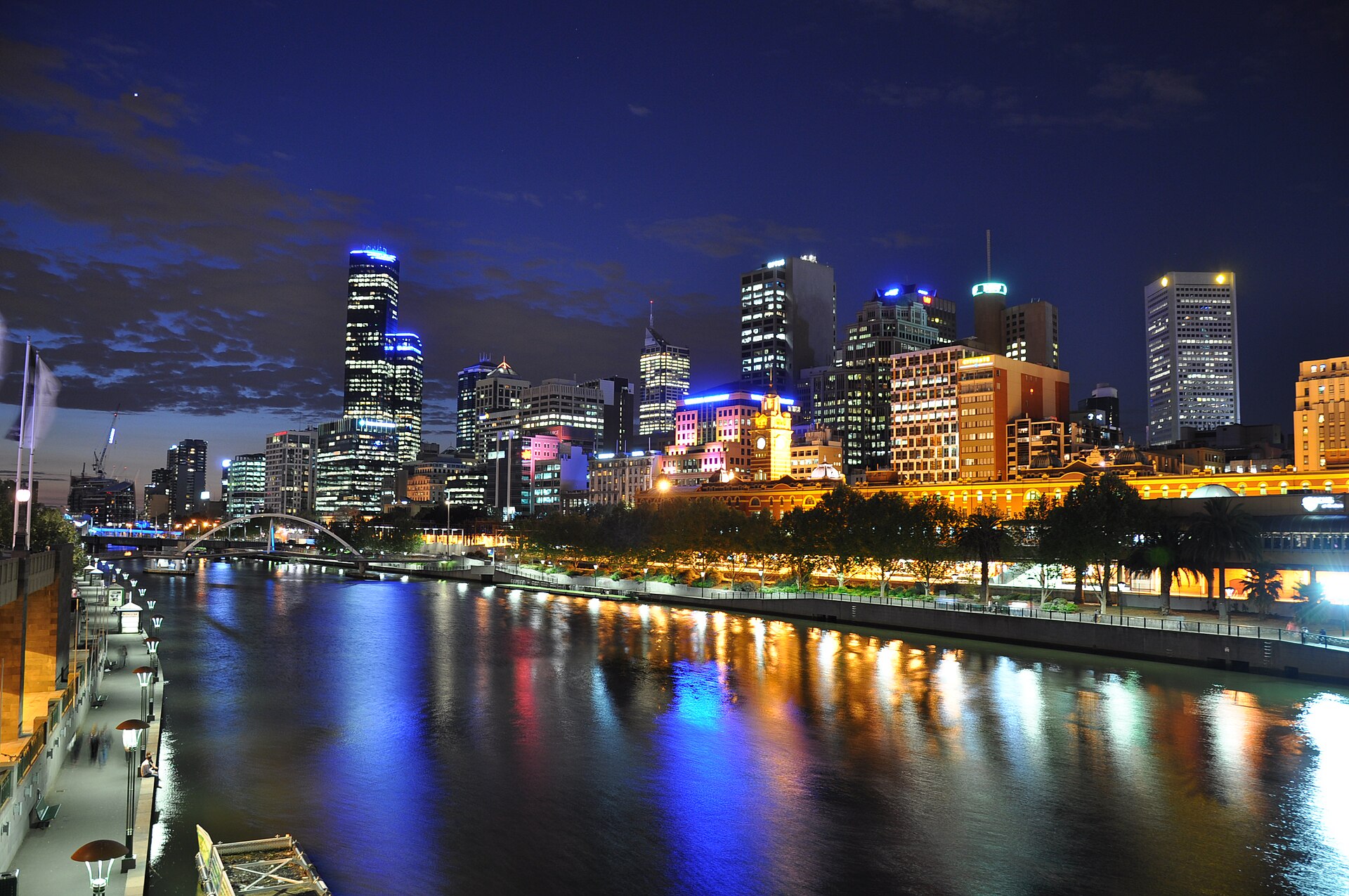
.jpg)
Melbourne exists where it does because of a rock bar. A little upstream of the present Queens Bridge, a natural ledge of stone crossed the river, and it did two things at once: it stopped salt water from moving further inland, so there was fresh water above it, and it stopped ocean going ships from moving further inland either, so there was a natural head of navigation below it. In 1835 the party that established the settlement chose the north bank at that point. Everything about the shape of central Melbourne follows from that decision, and the falls themselves are gone, blasted away in the nineteenth century once they had ceased to be useful and become an obstacle.
The river is the Birrarung, the name used by the Wurundjeri Woi Wurrung people, whose country lies along its middle and lower course north of the water, with Boon Wurrung country to the south. The name Yarra came from a misunderstanding recorded in the surveying party's notebooks: an Aboriginal term describing flowing or falling water, heard at the falls, was written down as though it were the river's name. That confusion has been acknowledged for a long time, and the two names now sit alongside each other in official use. The Yarra River Protection Act passed by the Victorian Parliament in 2017 carries a Woi Wurrung title, Wilip gin Birrarung murron, treats the river and its lands as one living and integrated natural entity, and established a statutory council for it that includes Wurundjeri representatives. That is an unusual legal framing, and it was deliberate.
A river that was rebuilt
The stretch through the city is not a natural watercourse in any meaningful sense. It is an engineering work laid over one. Through the second half of the nineteenth century Melbourne dredged the lower river, cut off its meanders, walled its banks and shifted its mouth. The most consequential intervention was the Coode Canal, built through the 1880s to a scheme by the British engineer Sir John Coode, which cut straight across a large loop near the mouth and left the abandoned bend as the feature still called Coode Island. Upstream, the Yarra Improvement Act of 1896 authorised further realignment between Princes Bridge and Church Street, and the works known as the Botanic Gardens Cut, carried out around the turn of the century, straightened the river past the gardens and eliminated a series of billabongs that had previously absorbed floodwater.
Those billabongs had been doing real work, and removing them is part of why the flat land beside the river flooded so badly afterwards. The low ground at the eastern edge of the city, now occupied by Birrarung Marr and the sports precinct, was formerly a swampy river flat. Much of Southbank and the Docklands sits on reclaimed or heavily modified ground. When Melbourne worries about flood risk along the lower Yarra, it is worrying about a floodplain it built on after removing the features that used to buffer it.
The bridges record the sequence. Princes Bridge, opened at the end of the 1880s, is the ceremonial crossing at the head of Swanston Street and replaced earlier structures on the same alignment. The Sandridge Bridge beside it began as a railway bridge carrying the line to Port Melbourne and was converted into a pedestrian crossing after the railway became a light rail route. Further upstream at the edge of the Botanic Gardens, Morell Bridge, completed at the very end of the nineteenth century, is an early reinforced concrete arch built under the Monier patent by the engineering firm in which John Monash was a partner, and it is one of the more important pieces of engineering heritage in the state. Each crossing marks a moment when the city decided the river was more barrier than asset.
The colour question, and other myths
Visitors ask about the brown. The standard local joke is that the Yarra flows upside down, with the mud on top, and the standard local assumption is that the colour means pollution. It does not. The dominant cause of the muddy appearance is fine clay sediment held in suspension, washed in from catchment soils and stirred by flow, and a clear river through this landscape would be the anomaly. This is not a claim that the river is clean. Water quality in the lower reaches is genuinely poor after heavy rain, because the older inner suburbs drain rapidly off hard surfaces and carry road runoff, litter and occasional sewer overflow into the channel, which is why swimming advice is tied to recent rainfall. But the colour and the contamination are separate matters, and conflating them lets the actual problem hide behind an aesthetic one.
A second correction concerns Melbourne's relationship with its own waterfront. It is often said that the city turned its back on the river until the 1990s. That is roughly true of the twentieth century, when the south bank was rail yards, wharves and industry, but it inverts the nineteenth, when the river was crowded with punts, boathouses, baths and rowing clubs, and the Yarra bank near the city was a well known site for public speech making. What happened was not simple neglect but a change of use: a working river became an industrial edge, and then, from the Southbank promenade of the early 1990s onward, a promenade with restaurants behind it.
Following the bend on foot
The best way to understand the geometry is to walk it upstream. From Federation Square, opened in 2002 on a deck over the railway lines, cross into Birrarung Marr, a park created around the same time on land recovered from railway use and named in consultation with Wurundjeri elders. The path continues past the boathouses and the Morell Bridge, along the edge of the Royal Botanic Gardens, and out through Burnley and Hawthorn. Keep going and the river changes character entirely, from a walled channel to a genuinely wooded valley at Yarra Bend Park and Studley Park, where the Merri Creek joins from the north at Dights Falls, the site of an early mill and now of a fishway built to let native fish pass the weir.
That transition, from concrete edge to river red gums within about six kilometres of the central business district, is the thing most newcomers do not expect and the reason Melburnians talk about the Yarra with more affection than its reputation would suggest. The slow bend through the city is the most altered and least attractive part of it. Follow it a little further and you are on a river again.
References
- eMelbourne, The Encyclopedia of Melbourne Online, University of MelbourneYarra River
- eMelbourne, The Encyclopedia of Melbourne Online, University of MelbourneYarra Bank and Yarra Bankers
- City of MelbourneBirrarung Marr
- City of MelbourneOur waterways
- State Library VictoriaRiverside delights on the Yarra
This is a reference article, written from the sources above. It is background, not news reporting.